SURVEYS
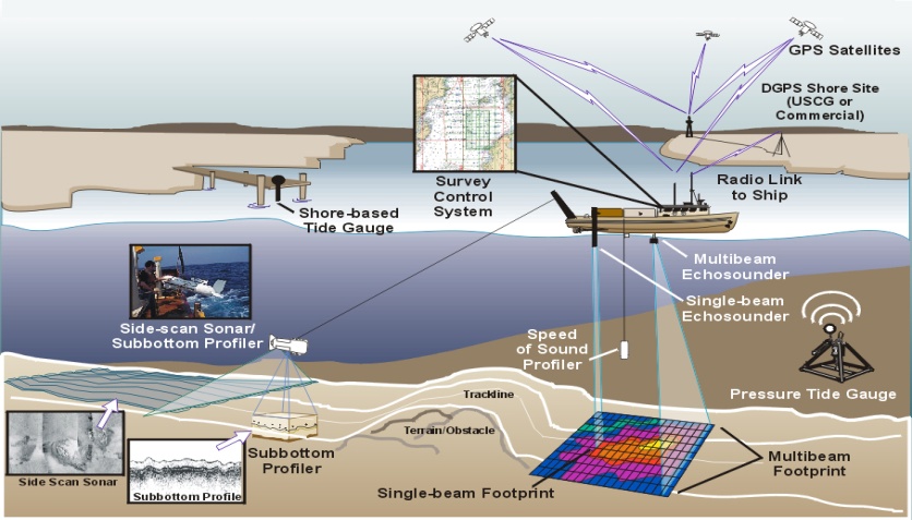
IN.TEC uses high resolution geophysical and Hydrographic systems to acquire data in the entire range of water depths from very shallow to very deep. The raw data is processed by our expert team in order to provide our Clients with:
-
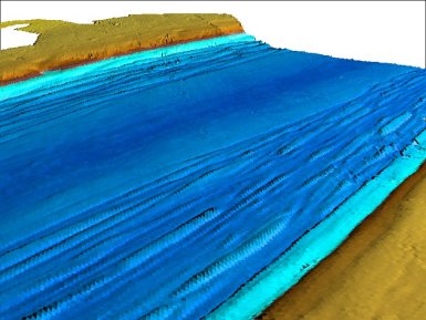
Bathymetric charting of the seabed;
-
Identification and mapping of seabed features such as debris, shipwrecks and subsea structures;
-
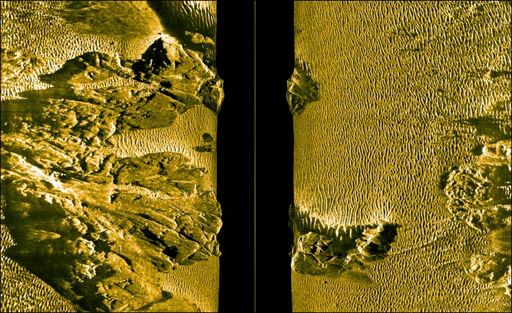
Digital seabed imagery;
-
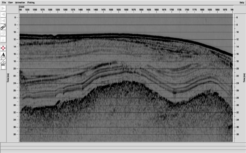
Profiles of seabed geological features;
-
Identification of the sub-bottom geophysical and lithological parameters;
-
Identification of buried facilities and hazards.
Applications
-
Harbour and Coastal Surveys;
-
Field and site surveys;
-
Archaeological survey;
-
Hydrographical survey;
-
Geophysical survey;
-
Geotechnical survey;
-
Data Processing and Charting
Instrumentation
-
Boomers and sparkers
-
Pingers
-
Chirp profilers
-
Side Scan Sonar
-
Magnetometers
-
Combined SSS-SBP
-
Dual frequency echosounders
-
DGPS and RTK positioning receivers
-
Multi-beam Echosounder
-
Piston Corer
-
Vibro Corer